or Sapa, is a frontier town and capital of Sa Pa District in Lào Cai Province in northwest Vietnam. It is one of the main market towns in the area, where several ethnic minority groups such as Hmong, Dao (Yao), Giáy, Pho Lu, and Tay live.
Sa Pa is a frontier town and capital of Sa Pa District in Lào Cai Province in northwest Vietnam. It was first inhabited by people we know nothing about. They left in the entire valley hundreds of petroglyphs, mostly composed of lines, which experts think date from the 15th century and represent local cadastres. Then came the highland minorities of the Hmong and Yao. The town is one of the main market ones in the area, where several ethnic minority groups such as Hmong, Dao (Yao), Giáy, Pho Lu, and Tay live. groups, as well as by smaller numbers of Tày and Giay. These are the four main minority groups still present in Sa Pa district today. The Kinh (lowland Vietnamese) never originally colonised this highest of Việt Nam’s valleys, which lies in the shadow of Phan-Xi-Pǎng (Fansipan, 3143 m), the highest peak in the country.[1]
History
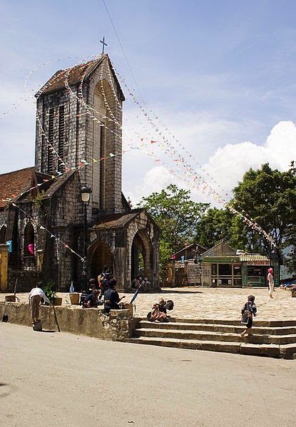
The Catholic church in Sa Pa, built in stone in 1930
It was only when the French debarked in highland Tonkin in the late 1880s that Sa Pa, or Chapa (from Chinese Xa Pa, the "sandy place"), as the French called it, began to appear on the national map. In the following decade, the future site of Sa Pa town started to see military parties as well as missionaries from the Société des Missions Etrangères de Paris (MEP) visit.[2] The French military marched from the Red River Delta into the northern mountainous regions as part of Tonkin's ‘pacification’. In 1894-96 the border between China and Tonkin was formally agreed upon and the Sa Pa area, just to the south of this frontier, was placed under French authority. From 1891 the entire Lào Cai region, including Sa Pa, came under direct colonial military administration so as to curtail banditry and political resistance on the sensitive northern frontier.[3]
The first permanent French civilian resident arrived in Sa Pa in 1909. With its attractive continental climate, health authorities believed the site had potential. By 1912 a military sanatorium for ailing officers had been erected along with a fully fledged military garrison. Then, from the 1920s onwards, several wealthy professionals with enough financial capital also had a number of private villas built in the vicinity.
At the end of the Second World War a long period of hostilities began in Tonkin that was to last until 1954. In the process, nearly all of the 200 or so colonial buildings in or around Sa Pa were destroyed, either by Việt Minh sympathisers in the late 1940s, or, in the early 1950s by French air raids. The vast majority of the Viet population fled for their lives, and the former town entered a prolonged sleep.
In the early 1960s, thanks to the New Economic Zones migration scheme set up by the new Socialist regime, new inhabitants from the lowlands started to migrate to the region.
The short 1979 occupation of the northern border region by Chinese troops had little impact on Sa Pa town, but did force the Kinh (lowland Vietnamese) population out for a month.
In 1993 the last obstacle to Sa Pa's full rebirth as a prominent holiday destination was lifted as the decision was made to open the door fully to international tourism. Sa Pa was back on the tourist trail again, this time for a newly emerging local elite tourist crowd, as well as international tourists.[4]
Sapa is now in full economic boom, mainly from the thousands of tourists who come every year to walk the hundreds of miles of trekking trails between and around the villages of Dao villages of Ta Van and Ta Phin.
In 2006, the Chairman of The People's Committee of Sapa Province was elected to The Communist Party Central Committee as the youngest ever member (born in 1973).
Geography
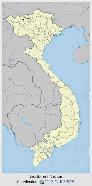
Sa Pa District is located in Lào Cai Province, north-west Vietnam, and 380 km north-west of Hanoi, close to the border with China. The Hoàng Liên Son range of mountains dominates the district, which is at the eastern extremity of the Himalayas. This range includes Vietnam's highest mountain, Fan Si Pan, at a height of 3143 m above sea level. The town of Sa Pa lies at an altitude of about 1500 meters (4921 feet) above sea level. The climate is moderate and rainy in summer (May—August), and foggy and cold with occasional snowfalls in winter.
View on the mountains from downtown Sapa
Sa Pa is a quiet mountain town and home to a great diversity of ethnic minority peoples. The total population of 36,000 consists mostly of minority groups. Besides the Kinh (Viet) people (15%) there are mainly 5 ethnic groups in Sapa: Hmong 52%, Dao 25%, Tay 5%, Giay 2% and a small number of Xa Pho. Approximately 7,000 live in Sapa, the other 36,000 being scattered in small communes throughout the district.
Terraced fields in Sa Pa
Most of the ethnic minority people work their land on sloping terraces since the vast majority of the land is mountainous. Their staple foods are rice and corn. Rice, by its very nature of being a labour intensive crop, makes the daily fight for survival paramount. The unique climate in Sapa has a major influence on the ethnic minorities who live in the area. With sub-tropical summers, temperate winters and 160 days of mist annually, the influence on agricultural yields and health related issues are significant.
The geographical location of the area makes it a truly unique place for many interesting plants and animals, allowing it to support many inhabitants. Many very rare or even endemic species have been recorded in the region.
Sa Pa town hall
The scenery of the Sa Pa region in large part reflects the relationship between the minority people and nature. This is seen especially in the paddy fields carpeting the rolling lower slopes of the Hoàng Liên Mountains. The impressive physical landscape which underlies this has resulted from the work of the elements over thousands of years, wearing away the underlying rock. On a clear day, the imposing peak of Fan Si Pan comes into view. The last major peak in the Himalayan chain, Fan Si Pan offers a real challenge to even the keenest walker, the opportunity of staggering views, and a rare glimpse of some of the last remaining primary rain forest in Vietnam.
Geology, climate and human activity have combined to produce a range of very distinct habitats around Sa Pa. Especially important is Sa Pa's geographic position, at the convergence of the world's 14 “biomes” (distinct biographic areas), producing an assemblage of plant and animal species unique in the world.
In 2014, Sapa is ranked #9 in the top 10 rice terrace destinations of the world by SpotCoolStuff
Ecological life
The Hoàng Liên Mountains are home to a rich variety of plants, birds, mammals, amphibians, reptiles and insects, many only found in northwestern Vietnam. For this reason, the Hoàng Liên Nature Reserve was made a National Park in 2006, and covers much of the mountain range to the immediate south of Sa Pa.
Forest type and quality change with increasing altitude. At 2000 meters the natural, undisturbed forest begins to be seen. Above 2500 meters dwarf conifers and rhododendrons predominate in the harsh “elfin forest” , so called because a lack of topsoil and nutrients means that fully mature trees grow to measure only a few meters in height. Higher still, only the hardiest of plant species are found. At over 3000 meters, Fan Si Pan's summit can only support dwarf bamboo.
Topography
The Hoang Lien Mountains lie at the southeastern extent of the Himalayan chain. The national park is located on the northeast flank of these mountains and includes Vietnam's highest peak, Fansipan, at 3,143 m (see map). The lowest point is 380 m but most of the national park lies above 1,000 m. The flanks of the mountains are very steep and many areas are almost inaccessible on foot. Between Fansipan Mountain and Sa Pa town, lies the Muong Hoa valley, which has been terraced for wet rice agriculture. This valley becomes wider towards the east of the national park.
Climate
The climate of Hoàng Liên National Park is unique to Vietnam. It is highly seasonal, with a subtropical climate in the summer and a temperate climate during the winter. Under the Köppen climate classification, Sa Pa has a subtropical highland climate (Cwb). Mean annual temperature for Sa Pa town is 15.4 °C (59.7 °F), with a maximum of 29.4 °C (84.9 °F) and a minimum of 1.0 °C (33.8 °F). The warmest months are July and August, and the coldest months are December and January. Snow falls in some years on the highest peaks. It has snown in the town itself in 1983,[5] 2000,[5][6] 16 March 2011,[5][6][7] 15 December 2013,[8][9][10][11] and 19 February 2014.[12]
In common with the rest of northern Vietnam, Hoàng Liên National Park experiences a marked wet season from May to September, with the heaviest rainfall occurring in July and August. Mean annual rainfall is 2,763 millimetres (108.8 in), with a high of 4,023 millimetres (158.4 in) and a low of 2,064 millimetres (81.3 in). Humidity ranges from 75 to 91 percent with a yearly mean of 86 percent.
Climate varies considerably within the national park. The prevalent wind direction for most of the year is west to east, leading to cloud formation on the upper slopes of the Fansipan massif. These high-altitude areas are covered by cloud most days of the year and have very high humidity. Cloud also penetrates into the valleys but these areas are usually less humid than the mountain slopes. In the extreme east of the national park, around Ban Ho village, mean temperatures are considerably higher due to the lower altitude of these areas.
Extreme temperatures have ranged from −6.1 °C (21.0 °F) to 33 °C (91.4 °F).[13]
Geology
The geology of Hoàng Liên National Park includes metamorphosed sediments and a granitic intrusion. The metamorphosed sediments strike from northwest to southeast along the Muong Hoa valley. On the northeastern side of the valley is a craggy ridge of marble and metamorphosed carbonate rocks that exhibit a karst style of weathering. These formations are currently being quarried for road building. The valley floor is characterised by schist and, to a lesser extent, gneiss. The granitic intrusion extends from the Muong Hoa River to the summit ridge of Fansipan and beyond. Due to the high humidity and rainfall in the area, chemical weathering is prevalent. This is reflected in the clay nature of the soil.
Economic and social development
Before the 1990s, the town's economy was mainly based on small size agriculture.
Tourist arrival between 1995 and 2003 grew from a total of 4,860 to 138,622. On average, 79% of the visitors are Vietnamese and 21% are foreigners.[citation needed]
The people of the Sa Pa area have been very poor even by Vietnam's rural standards.[16] Efforts to improve the situation for the local people include both governmental and non-governmental initiatives. The government of Vietnam and foreign governments have contributed to local development programs.[17] International non-governmental organizations such as Oxfam have also been involved in Sa Pa.[18] Locally, the Hmong-run social enterprise, Sapa O'Chau, organizes volunteer placements, such as English teaching, and visiting through trekking and homestays at local villages for short or long-term periods.[19] Vocational training by the Hoa Sua School also aims to increases skills and earnings potential for local residents.[20]
Hydrology
Hoàng Liên National Park is drained by the Muong Hoa and Ta Trung Ho rivers, which feed the Nam Po River and, finally, the Song Hong (Red) river. The forest has an essential role in water catchment protection, particularly the forest at high altitudes, which is frequently covered in cloud. Water condenses on the vegetation and falls as ‘occult’ precipitation. Occult precipitation makes a major contribution to stream-flow during the dry season when rainfall is low.
Vegetation
The forest of Hoàng Liên National Park can be classified as belonging to 3 types: sub-montane dry evergreen forest, tropical montane deciduous forest and sub-alpine forest. The sub-montane dry evergreen forest, which occurs at lower altitudes, has been the most heavily disturbed by the activities of man.
In addition to the forest habitats, the national park contains large areas of agricultural land, scrub land and Savannah. Agriculture is concentrated at altitudes below 1,500m, in the bottom of valleys. Scrub land and Savannah areas are found where forest has been cleared: around the edge of cultivated areas and on ridge tops, which have been subjected to burning. A final vegetation type represented at Hoàng Liên National Park is dwarf bamboo. This habitat is confined to the highest ridges of the Fansipan massif, at altitudes above 2,800 m.
Showing posts with label Travel. Show all posts
Showing posts with label Travel. Show all posts
Thursday, July 3, 2014
Thursday, June 26, 2014
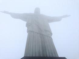
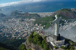
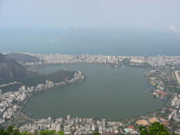
Visit Rio De Janeiro
Corcovado Mountain and Christ Redeemer Statue Half-Day Tour
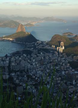
Rio de Janeiro (/ˈriːoʊ di ʒəˈnɛəroʊ, -deɪ ʒə-/; Portuguese pronunciation: [ˈʁi.u dʒi ʒɐˈnejɾu],[2] January River), commonly referred to as simply Rio,[3] is the capital city of the State of Rio de Janeiro, the second largest city of Brazil, and the third largest metropolitan area and agglomeration in South America. There are approximately 6.3 million people living within the city proper,[4][5] making it the 6th largest in the Americas and 26th in the world.[6] Part of the city has been designated as a World Heritage Site, named "Rio de Janeiro: Carioca Landscapes between the Mountain and the Sea", identified by UNESCO on 1 July 2012 in the category Cultural Landscape.[7]
Founded in 1565, by the Portuguese, the city was initially the seat of the Captaincy of Rio de Janeiro, a captaincy of the Portuguese Empire. It later, in 1793, became the capital of the State of Brazil, a State of the Portuguese Empire. In 1808, when the Portuguese Royal Court transferred itself from Portugal to Brazil, Rio de Janeiro became the chosen seat of the court of Queen Maria I of Portugal, who subsequently, in 1815, under the leadership of her son, the Prince Regent, and future King João VI of Portugal, raised Brazil to the dignity of a kingdom, within the United Kingdom of Portugal, Brazil, and Algarves. Rio stayed the capital of the pluricontinental Lusitanian monarchy until 1822, when the War of Brazilian Independence began. It subsequently served as the capital of the independent monarchy, the Empire of Brazil, until 1889, and then the capital of a republican Brazil until 1960.
Rio de Janeiro represents the second largest GDP in the country[8] (and 30th largest in the world in 2008),[9] estimated at about R$343 billion (IBGE/2008) (nearly US$201 billion), and is headquarters to two of Brazil's major companies—Petrobras and Vale, and major oil companies and telephony in Brazil, besides the largest conglomerate of media and communications companies in Latin America, the Globo Organizations. The home of many universities and institutes, it is the second largest center of research and development in Brazil, accounting for 17% of national scientific production—according to 2005 data.[10]
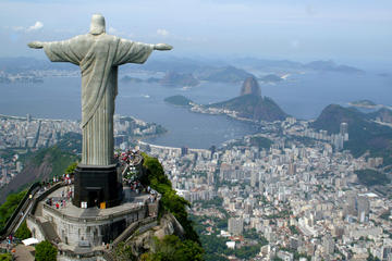
Rio de Janeiro is one of the most visited cities in the southern hemisphere and is known for its natural settings, carnival celebrations, samba, Bossa Nova, balneario beaches[11] such as Barra da Tijuca, Copacabana, Ipanema, and Leblon. Some of the most famous landmarks in addition to the beaches include the giant statue of Christ the Redeemer ("Cristo Redentor") atop Corcovado mountain, named one of the New Seven Wonders of the World; Sugarloaf mountain (Pão de Açúcar) with its cable car; the Sambódromo, a permanent grandstand-lined parade avenue which is used during Carnival; and Maracanã Stadium, one of the world's largest football stadiums.
Rio de Janeiro will host the 2016 Summer Olympics and the 2016 Summer Paralympics. This will be the first time a South American and Portuguese-speaking nation hosts the event. It will be the third time the Olympics will be held in a Southern Hemisphere city.[12] On 12 August 2012, at the 2012 Summer Olympics closing ceremony, Mayor Eduardo Paes received the Olympic Flag, via Jacques Rogge, from London Mayor Boris Johnson. Rio's Maracanã Stadium, which held the final of the 1950 FIFA World Cup and 2013 FIFA Confederations Cup, will host the final match of the 2014 FIFA World Cup.[13] Rio de Janeiro also hosted the World Youth Journey in 2013.[14]
Monday, June 2, 2014
2014 FiFa World Cup Brazil football matches
| Group A | |||||||
|---|---|---|---|---|---|---|---|
| 12/06/2014 | 21:00 | Brazil | - | Croatia | |||
| 13/06/2014 | 17:00 | Mexico | - | Cameroon | |||
| 17/06/2014 | 20:00 | Brazil | - | Mexico | |||
| 18/06/2014 | 23:00 | Cameroon | - | Croatia | |||
| 23/06/2014 | 21:00 | Cameroon | - | Brazil | |||
| 21:00 | Croatia | - | Mexico | ||||
| Group B | |||||||
| 13/06/2014 | 20:00 | Spain | - | Netherlands | |||
| 23:00 | Chile | - | Australia | ||||
| 18/06/2014 | 17:00 | Australia | - | Netherlands | |||
| 20:00 | Spain | - | Chile | ||||
| 23/06/2014 | 17:00 | Australia | - | Spain | |||
| 17:00 | Netherlands | - | Chile | ||||
| Group C | |||||||
| 14/06/2014 | 17:00 | Colombia | - | Greece | |||
| 15/06/2014 | 02:00 | Ivory Coast | - | Japan | |||
| 19/06/2014 | 17:00 | Colombia | - | Ivory Coast | |||
| 23:00 | Japan | - | Greece | ||||
| 24/06/2014 | 21:00 | Japan | - | Colombia | |||
| 21:00 | Greece | - | Ivory Coast | ||||
| Group D | |||||||
| 14/06/2014 | 20:00 | Uruguay | - | Costa Rica | |||
| 23:00 | England | - | Italy | ||||
| 19/06/2014 | 20:00 | Uruguay | - | England | |||
| 20/06/2014 | 17:00 | Italy | - | Costa Rica | |||
| 24/06/2014 | 17:00 | Costa Rica | - | England | |||
| 17:00 | Italy | - | Uruguay | ||||
| Group E | |||||||
| 15/06/2014 | 17:00 | Switzerland | - | Ecuador | |||
| 20:00 | France | - | Honduras | ||||
| 20/06/2014 | 20:00 | Switzerland | - | France | |||
| 23:00 | Honduras | - | Ecuador | ||||
| 25/06/2014 | 21:00 | Honduras | - | Switzerland | |||
| 21:00 | Ecuador | - | France | ||||
| Group F | |||||||
| 15/06/2014 | 23:00 | Argentina | - | Bosnia-Herzegovina | |||
| 16/06/2014 | 20:00 | Iran | - | Nigeria | |||
| 21/06/2014 | 17:00 | Argentina | - | Iran | |||
| 23:00 | Nigeria | - | Bosnia-Herzegovina | ||||
| 25/06/2014 | 17:00 | Nigeria | - | Argentina | |||
| 17:00 | Bosnia-Herzegovina | - | Iran | ||||
| Group G | |||||||
| 16/06/2014 | 17:00 | Germany | - | Portugal | |||
| 23:00 | Ghana | - | USA | ||||
| 21/06/2014 | 20:00 | Germany | - | Ghana | |||
| 22/06/2014 | 23:00 | USA | - | Portugal | |||
| 26/06/2014 | 17:00 | Portugal | - | Ghana | |||
| 17:00 | USA | - | Germany | ||||
| Group H | |||||||
| 17/06/2014 | 17:00 | Belgium | - | Algeria | |||
| 23:00 | Russia | - | South Korea | ||||
| 22/06/2014 | 17:00 | Belgium | - | Russia | |||
| 20:00 | South Korea | - | Algeria | ||||
| 26/06/2014 | 21:00 | Algeria | - | Russia | |||
| 21:00 | South Korea | - | Belgium | ||||
| Round of 16 | |||||||
| 28/06/2014 | 17:00 | Sieger Gruppe A | - | Zweiter Gruppe B | |||
| 21:00 | Sieger Gruppe C | - | Zweiter Gruppe D | ||||
| 29/06/2014 | 17:00 | Sieger Gruppe B | - | Zweiter Gruppe A | |||
| 21:00 | Sieger Gruppe D | - | Zweiter Gruppe C | ||||
| 30/06/2014 | 17:00 | Sieger Gruppe E | - | Zweiter Gruppe F | |||
| 21:00 | Sieger Gruppe G | - | Zweiter Gruppe H | ||||
| 01/07/2014 | 17:00 | Sieger Gruppe F | - | Zweiter Gruppe E | |||
| 21:00 | Sieger Gruppe H | - | Zweiter Gruppe G | ||||
| Quarter-finals | |||||||
| 04/07/2014 | 17:00 | Sieger AF 5 | - | Sieger AF 6 | |||
| 21:00 | Sieger AF 1 | - | Sieger AF 2 | ||||
| 05/07/2014 | 17:00 | Sieger AF 7 | - | Sieger AF 8 | |||
| 21:00 | Sieger AF 3 | - | Sieger AF 4 | ||||
| Semi-finals | |||||||
| 08/07/2014 | 21:00 | Sieger VF 1 | - | Sieger VF 2 | |||
| 09/07/2014 | 21:00 | Sieger VF 4 | - | Sieger VF 3 | |||
| Third place | |||||||
| 12/07/2014 | 21:00 | Verlierer HF 1 | - | Verlierer HF 2 | |||
| Final | |||||||
| 13/07/2014 | 20:00 | Sieger HF 1 | - | Sieger HF 2 | |||
Wednesday, May 21, 2014
Thursday, May 15, 2014
Live each hour of the 2014 Festival - CANNES CLASSICS - Kieślowski owes nothing to chance
Twenty-seven years after its selection for Un Certain Regard, Blind Chance returns to Cannes in a restored version. This film – one of Kieślowski's earliest – painted such a telling picture of the dark side of communism that it was banned on release in the director's home country of Poland. Beyond this aspect, the film offers a philosophical take on free will and on the uncertainty principle, themes dear to the director's heart.
What would have happened had he not opened this door? Would she still be alive if she hadn't crossed the road? These questions, which continue to trouble us at the end of the film, have been well thought out in advance by Krzysztof Kieślowski. His character, Witek, chases after the train. And with that, the director opens up the field of possibilities and explores three endings for the story.
What would have happened had he not opened this door? Would she still be alive if she hadn't crossed the road? These questions, which continue to trouble us at the end of the film, have been well thought out in advance by Krzysztof Kieślowski. His character, Witek, chases after the train. And with that, the director opens up the field of possibilities and explores three endings for the story.

Photo of the film © RR
Witek manages to board the train and thanks to the people he meets, joins the Party. Another sequence, another hypothesis: stopped by the ticket inspector, he misses the train, gets into a quarrel, is arrested and ends up involved with the Opposition. In the final option, the train continues on its way. Witek gets married and becomes a doctor. But irrespective of the scenarios envisaged – even the happiest on the surface – destiny turns Witek's life upside down and ultimately destroys it.
Three films Intertwined in one. This work is imbued with the pessimism that pervades Kieślowski's entire filmography. Shot well before The Double Life of Véronique (1991) and the Three colours trilogy (1993-1994).Blind Chance is without a doubt one of the most philosophical films of the director's career. Do we have a choice? Is free will a mirage? What role is played by the inescapable? Still topical 33 years after the making of the films, these questions are in fact timeless .
Restored in 2K, with calibration supervised by the director of photography
Tarik Khaldi
Tuesday, May 13, 2014
Travel gallery
Amon Temple Karnak
Bejaias Algeria
Bellagio Italia
Colomares Castle Spain
Constantine
Egypt
Hillside-Homes-Sichuan-China
phusi-japan
Sibam Yeman
Suluban Beach Uluwatu Bali
Vience
tags: travel gallery, travel image, nice pic, niceaddress.blogspot.com
Subscribe to:
Posts (Atom)

